
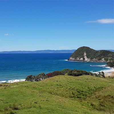
Whangāreiweather
- Updated
- Sunrise:
- Sunset:
20°C
- 21°C18°C
Rain with heavy falls, easing this evening. Gale northeasterlies, easing this evening.
- 24°C17°C
Partly cloudy, with occasional showers. Possibly heavy in the morning with thunderstorms and downpours also possible. Light winds.
- 22°C16°C
A few showers, widespread and heavier in the morning and afternoon. Northeasterlies developing for a time in the afternoon.
For more detailed weather information visit MetService.
Marine Recreational Forecasts - Whangārei
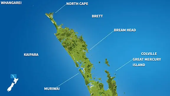
Area Description:
Bream Head to Cape Colville
Situation:
A subtropical low over Northland moves down the west of the country bringing a strong northeast flow over New Zealand. Another low and trough approaches from the southwest and moves onto the country tomorrow. On Thursday, the trough is expected to weaken over the eastern North Island while a ridge of high pressure moves onto the South Island. High pressure prevails across the country on Friday. On Saturday, a ridge of high pressure remains over central New Zealand, while a deep tropical low approaches the North Island from the north. Also, a front approaches the far south of the South Island late in the day.
Warnings:
Gale warning
Forecasts:
For Bream Head to Cape Colville:
Today: Easterly 35 knots gusting 45 knots but 40 knots gusting 50 knots about Colville Channel. Easing to northeast 25 knots gusting 35 knots but 30 knots gusting 40 knots about the Channel in the evening. Very rough sea easing in the evening. Poor visibility in rain. Northeast swell 2.5 metres rising to 3 metres.
Outlook:
For Bream Head to Cape Colville:
Wednesday: Northeast 25 knots gusting 35 knots but 30 knots gusting 40 knots about the Colville Channel. Changing westerly 10 knots in the morning, then easing to variable 5 knots early afternoon. Southerly 10 knots developing in the evening. Rough sea easing in the morning. Periods of rain with very poor visibility in possible downpours and thunderstorms in the morning. Northeast swell 3 metres easing to 1.5 metres.
Thursday: Southerly 10 knots. Occasional rain. Northeast swell 1.5 metres.
Friday: Southerly 10 knots, rising to southeast 20 knots early. Cloud clearing and becoming fine. Northeast swell easing to 1 metre.
Saturday: Easterly 20 knots, rising to 30 knots early. Rain developing. Northeast swell rising to 4 metres.
Swell:
Marine Coastal Forecasts - Brett
Forecast:
Tuesday: Northeast 35 knots, easing to northeast 25 knots early evening, then to variable 10 knots late evening. Very rough sea easing. Northeast swell 3 metres. Poor visibility in rain.
Outlook:
Outlook following 3 days:
Wednesday: Variable 10 knots. Sea slight. Northeast swell 3 metre easing. Poor visibility in early morning and late evening rain.
Thursday: Northeast 10 knots, turning southeast 15 knots in the morning. Moderate northeast swell.
Friday: Southeast 15 knots, rising to 25 knots early. Sea becoming rough. Moderate easterly swell.
Saturday: Southeast 25 knots, rising to 35 knots early. Sea becoming very rough. Easterly swell becoming heavy.
Marine Coastal Forecasts - Colville
Forecast:
Tuesday: Northeast 35 knots. Easing to northeast 25 knots north of Great Barrier Island in the evening. Very rough sea easing in the north. Northeast swell rising to 3 metres. Poor visibility in rain.
Outlook:
Outlook following 3 days:
Wednesday: Northeast 30 knots, easing to variable 10 knots in the morning. Rough sea easing. Northeast swell 3 metre easing. Poor visibility in rain.
Thursday: Variable 10 knots. Moderate northeast swell.
Friday: Easterly 15 knots, rising to 25 knots later. Sea becoming rough. Moderate northeast swell.
Saturday: Easterly 30 knots. Sea rough. Easterly swell becoming heavy.